CHARGEMENT EN COURS...
Référence:
DAEX-T158
/ 3913
Référence:
DAEX-T158
Pays:
PT
Région:
São Miguel
Ville:
Lagoa
Code postal:
9560-450
Catégorie:
Résidentiel
Type d'annonce:
Vente
Type de bien:
Terrain
Surface:
69 m²
Surface constructible:
22 640 m²
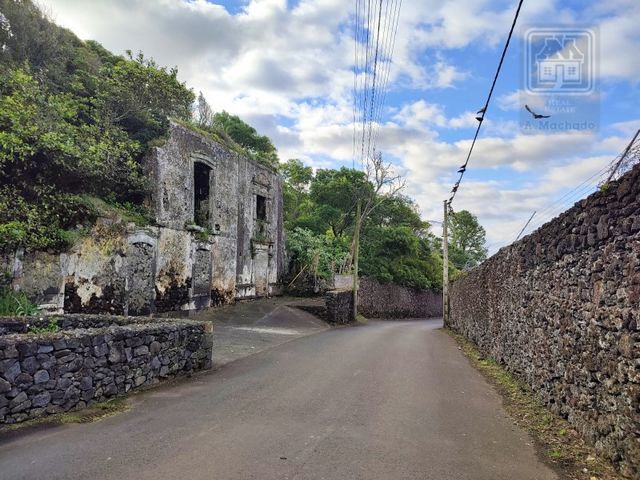
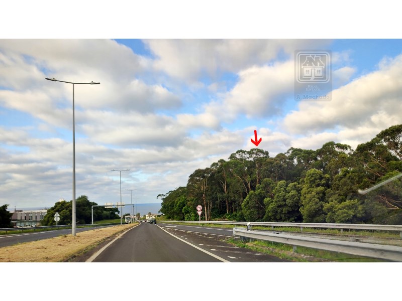
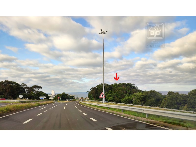
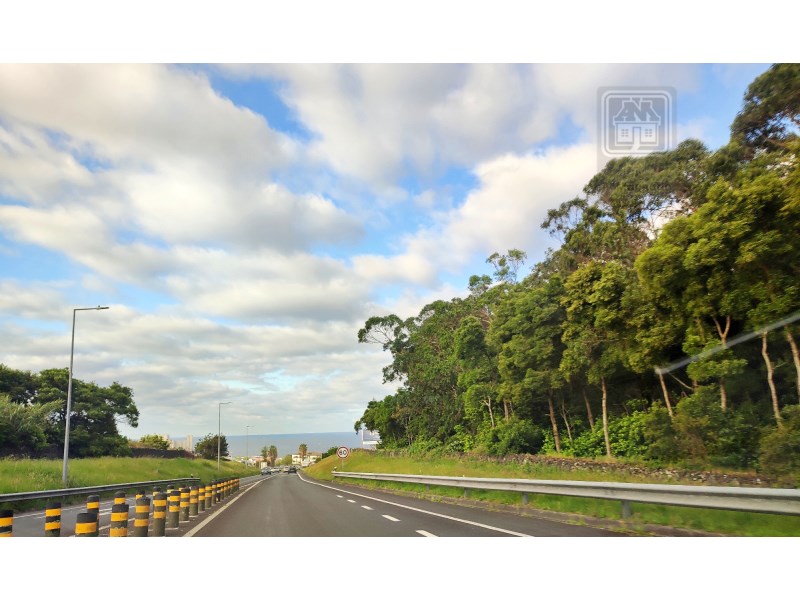
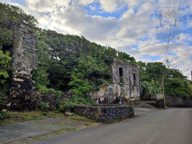
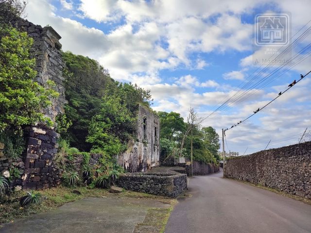
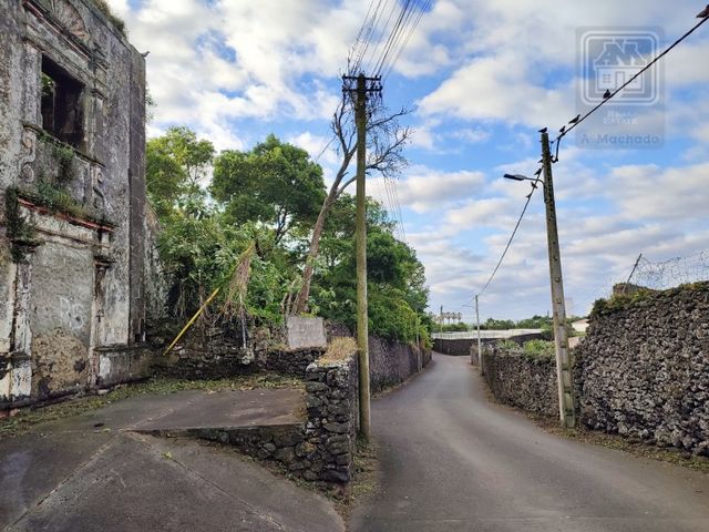
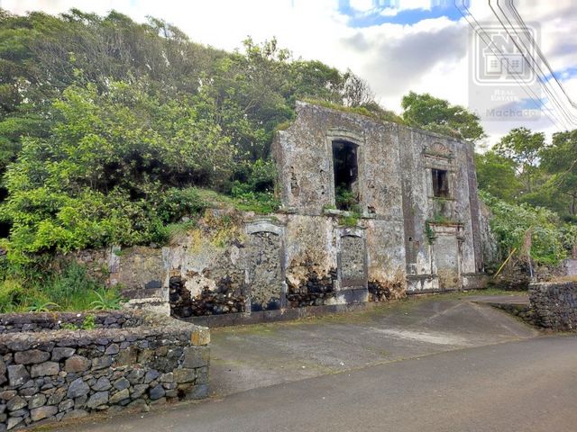
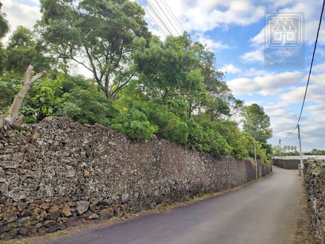
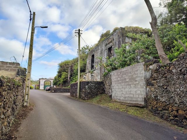
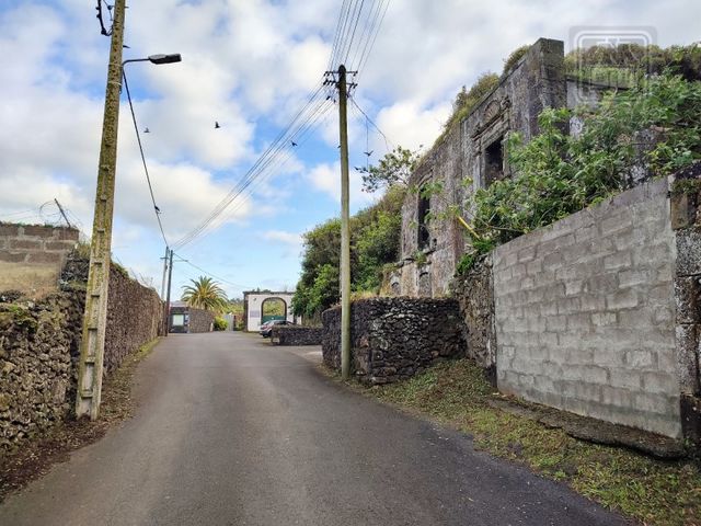
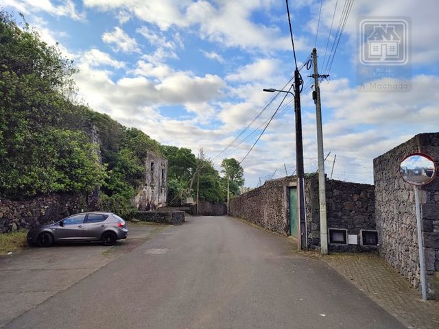
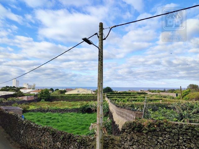
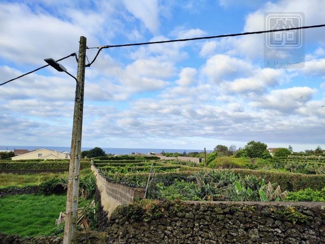
Le front restant (82 mètres) a une capacité constructive, et compte tenu de l'orientation du terrain vers le sud, les futures constructions possibles peuvent bénéficier de superbes vues sur la mer et la ville de Lagoa.Compte tenu des caractéristiques du bien (tant en termes de superficies qu'en termes d'emplacement), il s'agit d'une excellente opportunité d'investissement pour le développement d'un projet de logement (lotissement ou construction en hauteur par exemple) ou même d'un développement touristique, en profitant de la superficie totale du terrain (zone urbaine et zone rustique).Selon le PDM (Plan directeur municipal) de Lagoa (Açores), le terrain (situé à droite de l'autoroute, dans le sens nord-sud) est classé comme suit:Environ 13 000 m2 (partie sud du terrain) font partie d'une zone classée comme terrain urbain > urbanisable > espaces centraux > niveau I (Vila de Lagoa);Régime de construction présent dans le règlement PDM:
Les dispositions suivantes s'appliquent à cette sous-catégorie d'espaces:
a) le taux d'occupation maximal ii): 50 %;
b) l'indice d'utilisation maximal (Iu): 1;
c) Le nombre maximum d'étages est de 3 (hauteur maximale de la façade de 9,5 m) pour les utilisations résidentielles et de 4 (hauteur maximale de la façade de 15 m) pour les services, les équipements publics, les développements touristiques, les structures commerciales et industrielles compatibles avec les terrains urbains;
d) Les typologies à construire devraient être les suivantes :
i) Dans les espaces centraux sur les terrains urbanisables, les typologies à considérer devraient être des logements unifamiliaux, bifamiliaux ou collectifs, des bâtiments commerciaux, de services ou mixtes;
ii) Dans les espaces résidentiels sur des terrains urbanisables, les typologies à considérer devraient être les maisons unifamiliales individuelles, jumelées ou à bandes, les bâtiments commerciaux, de services ou mixtes;
e) La construction d'annexes non résidentielles est autorisée, à condition qu'elles n'occupent pas une superficie supérieure à 10 % de la superficie totale du lot ou du bâtiment dans lequel elles se trouvent, qu'elles n'excèdent pas 40 m2, ni que la hauteur de la façade ne dépasse pas 3,5 mètres;
f) L'installation d'utilisations non résidentielles est autorisée chaque fois qu'elles sont compatibles avec le logement et à condition qu'elles aient un accès direct à l'espace public et indépendantes du logement et ne soient pas incompatibles avec les capacités de circulation et de stationnement disponibles et les réseaux d'infrastructures;
g) La morphologie urbaine à définir, notamment en ce qui concerne la structure de l'espace public et le langage des bâtiments, doit respecter et valoriser la morphologie et l'image urbaine environnante, en sauvegardant les zones de plus grande sensibilité, avec la définition du réseau routier, des espaces verts et être attribuée aux équipements conformément à la législation applicable.Surface restante, 7 760 m2 (partie nord du terrain) : elle fait partie de la zone classée des Espaces de Sol Rural > de Production Agricole ;La parcelle de terrain (article rustique) de 1 880 m2, située à côté de Tencoparque/Hia/Nonagon, selon le PDM en ligne de la municipalité de Lagoa/Açores), est classée comme suit:Terrains urbanisables > urbanisables > espaces centraux > niveau I (Vila de Lagoa); Dont le régime de comestibilité est mentionné ci-dessus.Commentaires : Les informations contenues dans le présent document concernant l'analyse PDM, y compris la quantité de zone qui relève de chaque catégorie PDM, ne doivent pas être considérées comme contraignantes. Toute demande de construction doit être soumise pour analyse par la municipalité de Lagoa (Açores). Biens exemptés de la classification énergétique;
Performance Énergétique: Exempt
#ref:3913 Voir plus Voir moins Gemischtes Gebäude (1 städtischer Artikel und 2 rustikale Artikel) mit einer Gesamtfläche von 22.640 m2 (2,26 Hektar), in der Gemeinde Nossa Senhora do Rosário, Gemeinde Lagoa (Azoren), derzeit bestehend aus Wald und Bau in einem Zustand der Ruine. Das städtische Grundstück hat 3.400 m2. Neben dem besagten städtischen Grundstück befindet sich ein rustikales Grundstück mit einer Gesamtfläche von 17.360 m2 und auf der anderen Seite der Straße / Straße befindet sich ein weiteres Grundstück (rustikaler Artikel) mit 1.880 m2 neben dem Tecnoparque.Das Grundstück profitiert von einer hervorragenden Lage und Zugänglichkeit, neben der Ausfahrt / Einfahrt der Autobahn, die die Stadt Lagoa mit den Gemeinden Ponta Delgada, Ribeira Grande und Vila Franca do Campo verbindet. Es befindet sich auch nur wenige Meter vom Internationalen Krankenhaus der Azoren (HIA), dem Tecnoparque da Lagoa, Nonagon, dem Continente-Hypermarkt, dem Restaurant Paladares da Quinta usw. entfernt. Es profitiert auch von einem einfachen Zugang zu Wasser-, Strom- und Kommunikationsinfrastrukturen.Das gemischte Grundstück (rechts von der Schnellstraße, Nord-Süd-Richtung) ist der Straße in einer Ausdehnung von ca. 110 Laufmetern zugewandt, und 28 Meter entsprechen der Fassade des städtischen Teils, der aus einer Ruine (früher mit 2 Stockwerken) besteht, deren registrierte Implantationsfläche 69 m2 betrug.
Die verbleibende Front (82 Meter) hat konstruktive Kapazität, und angesichts der Ausrichtung des Grundstücks nach Süden können die möglichen zukünftigen Bauten von einem großartigen Blick auf das Meer und die Stadt Lagoa profitieren.Unter Berücksichtigung der Eigenschaften der Immobilie (sowohl in Bezug auf die Fläche als auch in Bezug auf die Lage) ist es eine großartige Investitionsmöglichkeit für die Entwicklung eines Wohnprojekts (z. B. Wohnaufteilung oder Bau in der Höhe) oder sogar einer touristischen Entwicklung, wobei die Gesamtfläche des Grundstücks (städtisches Gebiet und rustikales Gebiet) genutzt wird.Gemäß dem PDM (Municipal Master Plan) von Lagoa (Azoren) ist das Grundstück (rechts von der Schnellstraße in Nord-Süd-Richtung gelegen) wie folgt klassifiziert:Etwa 13.000 m2 (südlicher Teil des Landes) sind Teil eines Gebiets, das als städtisches > urbanisierbares Land > zentrale Räume > Ebene I (Vila de Lagoa) klassifiziert ist.In der PDM-Verordnung enthaltenes Bauregime:
Für diese Unterkategorie von Flächen gelten folgende Bestimmungen:
a) die maximale Auslastung (Ii): 50 %;
b) der maximale Nutzungsindex (Iu): 1;
c) Die maximale Anzahl der Stockwerke beträgt 3 (maximale Fassadenhöhe von 9,5 m) für Wohnzwecke und 4 (maximale Fassadenhöhe von 15 m) für Dienstleistungen, öffentliche Einrichtungen, touristische Entwicklungen, gewerbliche und industrielle Strukturen, die mit städtischem Land vereinbar sind;
d) Die zu erstellenden Typologien sollten die folgenden sein:
i) In zentralen Räumen auf urbanisierbaren Grundstücken sollten die zu berücksichtigenden Typologien Einfamilien-, Zweifamilien- oder Gemeinschaftswohnungen, Gewerbe-, Dienstleistungs- oder Mischgebäude sein;
ii) Bei Wohnräumen auf urbanisierbaren Grundstücken sollten die zu berücksichtigenden Typologien freistehende, Doppel- oder Streifeneinfamilienhäuser, Gewerbe-, Dienstleistungs- oder gemischte Gebäude sein;
e) Der Bau von Nebengebäuden, die keine Wohngebäude sind, ist zulässig, sofern sie eine Fläche von mehr als 10 % der Gesamtfläche des Grundstücks oder Gebäudes, in dem sie sich befinden, nicht einnehmen, 40 m2 nicht überschreiten und die Höhe der Fassade 3,5 Meter nicht überschreitet;
f) Die Errichtung von Nichtwohnnutzungen ist zulässig, wenn sie mit der Wohnung vereinbar sind und sofern sie einen unmittelbaren Zugang zum öffentlichen Raum haben und von der Wohnung unabhängig sind und nicht mit den verfügbaren Verkehrs- und Parkkapazitäten und Infrastrukturnetzen unvereinbar sind;
g) Die zu definierende Stadtmorphologie, insbesondere im Hinblick auf die Struktur des öffentlichen Raums und die Sprache der Gebäude, muss die Morphologie und das umgebende Stadtbild respektieren und verbessern, wobei die Bereiche mit größerer Sensibilität geschützt werden, wobei das Straßennetz und die Grünflächen definiert und den Geräten gemäß den geltenden Rechtsvorschriften zugewiesen werden müssen.Verbleibende Fläche, 7.760 m2 (nördlicher Teil des Landes): Es ist Teil des klassifizierten Gebiets der ländlichen Böden > landwirtschaftlichen Produktionsräume;Das Grundstück (rustikaler Artikel) mit 1.880 m2, das sich neben Tencoparque/Hia/Nonagon befindet, ist laut dem Online-PDM der Gemeinde Lagoa/Azoren) klassifiziert als:Urbane > urbanisierbare Grundstücke > zentralen Räumen > Ebene I (Vila de Lagoa); Deren Regime der Essbarkeit oben erwähnt wird.Anmerkungen: Die hierin enthaltenen Informationen im Zusammenhang mit der PDM-Analyse, einschließlich der Größe der Fläche, die in jede PDM-Kategorie fällt, sollten nicht als verbindlich angesehen werden. Jeder Bauantrag muss von der Gemeinde Lagoa (Azoren) zur Analyse eingereicht werden. Immobilien, die von der Energieklassifizierung ausgenommen sind;
Energiekategorie: Befreit
#ref:3913 Edificio mixto (1 artículo urbano y 2 artículos rústicos) con una superficie total de 22.640 m2 (2,26 hectáreas), situado en la parroquia de Nossa Senhora do Rosário, municipio de Lagoa (Azores), actualmente consta de bosque y construcción en estado de ruina. La Parcela Urbana tiene 3.400 m2. Junto a dicha Parcela Urbana tiene una Parcela Rústica de 17.360 m2 de superficie total y al otro lado de la carretera/carretera hay otra Parcela de Terreno (artículo rústico) con 1.880 m2 situada junto al Tecnoparque.El terreno se beneficia de una excelente ubicación y acceso, junto a la salida / entrada de la carretera que conecta la ciudad de Lagoa con los municipios de Ponta Delgada, Ribeira Grande y Vila Franca do Campo. También se encuentra a pocos metros del Hospital Internacional de las Azores (HIA), Tecnoparque da Lagoa, Nonagon, hipermercado Continente, Paladares da Quinta Restaurant, etc. También se beneficia de un fácil acceso a las infraestructuras de agua, electricidad y comunicaciones.El terreno mixto (situado a la derecha de la autovía, dirección norte-sur) da a la calle en una extensión de aproximadamente 110 metros lineales, y 28 metros corresponden a la fachada de la parte urbana, que consiste en una construcción en ruinas (anteriormente con 2 plantas) cuya superficie de implantación registrada era de 69 m2.
El frente restante (82 metros) tiene capacidad constructiva, y dada la orientación del terreno hacia el sur, las posibles construcciones futuras pueden beneficiarse de excelentes vistas sobre el mar y la ciudad de Lagoa.Teniendo en cuenta las características del inmueble (tanto en términos de zonas como en cuanto a ubicación), es una gran oportunidad de inversión para el desarrollo de un proyecto habitacional (subparcelación de viviendas o construcción en altura por ejemplo) o incluso un desarrollo turístico, aprovechando la superficie total del terreno (zona urbana y zona rústica).Según el PDM (Plan Maestro Municipal) de Lagoa (Azores), el terreno (ubicado a la derecha de la autopista, dirección norte-sur) se clasifica de la siguiente manera:Aproximadamente 13.000 m2 (parte sur del terreno) forman parte de un área clasificada como Suelo Urbano > Urbanizable > Espacios Centrales > Nivel I (Vila de Lagoa);Régimen de edificación presente en la normativa PDM:
Se aplicarán a esta subcategoría del espacio las siguientes disposiciones:
a) el porcentaje máximo de ocupación (ii): 50 %;
b) el índice máximo de utilización (UI): 1;
c) El número máximo de plantas es de 3 (altura máxima de fachada de 9,5 m) para usos residenciales y 4 (altura máxima de fachada de 15 m) para servicios, equipamientos públicos, desarrollos turísticos, estructuras comerciales e industriales compatibles con suelo urbano;
d) Las tipologías a construir deben ser las siguientes:
i) En espacios centrales sobre suelo urbanizable, las tipologías a considerar deben ser viviendas unifamiliares, bifamiliares o colectivas, comerciales, de servicios o mixtas;
ii) En espacios residenciales sobre suelo urbanizable, las tipologías a considerar deben ser viviendas unifamiliares adosadas, adosadas o anilladas, comerciales, de servicios o mixtas;
e) Se permite la construcción de anexos no residenciales, siempre que no ocupen un área superior al 10 % del área total del lote o edificio en el que se encuentren, no excedan los 40 m2, ni una altura de la fachada superior a 3,5 metros;
f) Se permite la instalación de usos no residenciales siempre que sean compatibles con la vivienda y siempre que tengan acceso directo al espacio público e independiente de la vivienda y no sean incompatibles con las capacidades de circulación y estacionamiento disponibles y las redes de infraestructura;
g) La morfología urbana a definir, en particular en lo que respecta a la estructura del espacio público y el lenguaje de los edificios, debe respetar y mejorar la morfología y la imagen urbana circundante, salvaguardando las áreas de mayor sensibilidad, con definición de la red vial, espacios verdes y que se destinarán a equipos de acuerdo con la legislación aplicable.Área restante, 7.760 m2 (parte norte del terreno): forma parte del área clasificada de Suelo Rural > Espacios de Producción Agrícola;La parcela de terreno (artículo rústico) con 1.880 m2, situada junto a Tencoparque/Hia/Nonagon, según el PDM online del municipio de Lagoa/Azores), se clasifica en:Suelo Urbano > Urbanizable > Espacios Centrales > Nivel I (Vila de Lagoa); Cuyo régimen de comestibilidad se menciona anteriormente.Comentarios: La información contenida en este documento relacionada con el análisis PDM, incluida la cantidad de área que cae dentro de cada categoría PDM, no debe considerarse vinculante. Cualquier reclamación de construcción debe ser presentada para su análisis por el Ayuntamiento de Lagoa (Azores). Propiedad Exenta de Clasificación Energética;
Categoría Energética: Exento
#ref:3913 Bâtiment mixte (1 article urbain et 2 articles rustiques) d'une superficie totale de 22 640 m2 (2,26 hectares), situé dans la paroisse de Nossa Senhora do Rosário, municipalité de Lagoa (Açores), actuellement constitué de forêt et de construction en ruine. Le terrain urbain a 3 400 m2. À côté de ladite parcelle urbaine a une parcelle rustique de 17 360 m2 de superficie totale et de l'autre côté de la route / route il y a une autre parcelle de terrain (article rustique) avec 1 880 m2 situé à côté de la Tecnoparque.Le terrain bénéficie d'un excellent emplacement et d'un accès, à côté de la sortie / entrée de l'autoroute qui relie la ville de Lagoa aux municipalités de Ponta Delgada, Ribeira Grande et Vila Franca do Campo. Il est également situé à quelques mètres de l'hôpital international des Açores (HIA), Tecnoparque da Lagoa, Nonagon, l'hypermarché Continente, le restaurant Paladares da Quinta, etc. Il bénéficie également d'un accès facile aux infrastructures d'eau, d'électricité et de communication.Le terrain mixte (situé à droite de l'autoroute, direction nord-sud) fait face à la rue dans une extension d'environ 110 mètres linéaires, et 28 mètres correspondent à la façade de la partie urbaine, qui consiste en une construction en ruine (auparavant avec 2 étages) dont la surface d'implantation enregistrée était de 69 m2.
Le front restant (82 mètres) a une capacité constructive, et compte tenu de l'orientation du terrain vers le sud, les futures constructions possibles peuvent bénéficier de superbes vues sur la mer et la ville de Lagoa.Compte tenu des caractéristiques du bien (tant en termes de superficies qu'en termes d'emplacement), il s'agit d'une excellente opportunité d'investissement pour le développement d'un projet de logement (lotissement ou construction en hauteur par exemple) ou même d'un développement touristique, en profitant de la superficie totale du terrain (zone urbaine et zone rustique).Selon le PDM (Plan directeur municipal) de Lagoa (Açores), le terrain (situé à droite de l'autoroute, dans le sens nord-sud) est classé comme suit:Environ 13 000 m2 (partie sud du terrain) font partie d'une zone classée comme terrain urbain > urbanisable > espaces centraux > niveau I (Vila de Lagoa);Régime de construction présent dans le règlement PDM:
Les dispositions suivantes s'appliquent à cette sous-catégorie d'espaces:
a) le taux d'occupation maximal ii): 50 %;
b) l'indice d'utilisation maximal (Iu): 1;
c) Le nombre maximum d'étages est de 3 (hauteur maximale de la façade de 9,5 m) pour les utilisations résidentielles et de 4 (hauteur maximale de la façade de 15 m) pour les services, les équipements publics, les développements touristiques, les structures commerciales et industrielles compatibles avec les terrains urbains;
d) Les typologies à construire devraient être les suivantes :
i) Dans les espaces centraux sur les terrains urbanisables, les typologies à considérer devraient être des logements unifamiliaux, bifamiliaux ou collectifs, des bâtiments commerciaux, de services ou mixtes;
ii) Dans les espaces résidentiels sur des terrains urbanisables, les typologies à considérer devraient être les maisons unifamiliales individuelles, jumelées ou à bandes, les bâtiments commerciaux, de services ou mixtes;
e) La construction d'annexes non résidentielles est autorisée, à condition qu'elles n'occupent pas une superficie supérieure à 10 % de la superficie totale du lot ou du bâtiment dans lequel elles se trouvent, qu'elles n'excèdent pas 40 m2, ni que la hauteur de la façade ne dépasse pas 3,5 mètres;
f) L'installation d'utilisations non résidentielles est autorisée chaque fois qu'elles sont compatibles avec le logement et à condition qu'elles aient un accès direct à l'espace public et indépendantes du logement et ne soient pas incompatibles avec les capacités de circulation et de stationnement disponibles et les réseaux d'infrastructures;
g) La morphologie urbaine à définir, notamment en ce qui concerne la structure de l'espace public et le langage des bâtiments, doit respecter et valoriser la morphologie et l'image urbaine environnante, en sauvegardant les zones de plus grande sensibilité, avec la définition du réseau routier, des espaces verts et être attribuée aux équipements conformément à la législation applicable.Surface restante, 7 760 m2 (partie nord du terrain) : elle fait partie de la zone classée des Espaces de Sol Rural > de Production Agricole ;La parcelle de terrain (article rustique) de 1 880 m2, située à côté de Tencoparque/Hia/Nonagon, selon le PDM en ligne de la municipalité de Lagoa/Açores), est classée comme suit:Terrains urbanisables > urbanisables > espaces centraux > niveau I (Vila de Lagoa); Dont le régime de comestibilité est mentionné ci-dessus.Commentaires : Les informations contenues dans le présent document concernant l'analyse PDM, y compris la quantité de zone qui relève de chaque catégorie PDM, ne doivent pas être considérées comme contraignantes. Toute demande de construction doit être soumise pour analyse par la municipalité de Lagoa (Açores). Biens exemptés de la classification énergétique;
Performance Énergétique: Exempt
#ref:3913 Edificio misto (1 articolo urbano e 2 articoli rustici) con una superficie totale di 22.640 m2 (2,26 ettari), situato nella parrocchia di Nossa Senhora do Rosário, comune di Lagoa (Azzorre), attualmente costituito da foresta e costruzione in stato di rovina. Il terreno urbano ha 3.400 m2. Accanto al suddetto lotto urbano ha un pacco rustico 17.360 m2 di superficie totale e dall'altra parte della strada / strada c'è un altro appezzamento di terreno (articolo rustico) con 1.880 m2 situato vicino al Tecnoparque.Il terreno beneficia di ottima posizione e accesso, vicino all'uscita / ingresso dell'autostrada che collega la città di Lagoa ai comuni di Ponta Delgada, Ribeira Grande e Vila Franca do Campo. Si trova anche a pochi metri dall'Ospedale Internazionale delle Azzorre (HIA), Tecnoparque da Lagoa, Nonagon, ipermercato Continente, Ristorante Paladares da Quinta, ecc. Beneficia inoltre di un facile accesso all'acqua, all'elettricità e alle infrastrutture di comunicazione.Il terreno misto (situato a destra della superstrada, direzione nord-sud) si affaccia sulla strada in un'estensione di circa 110 metri lineari e 28 metri corrispondono alla facciata della parte urbana, che consiste in una costruzione in rovina (precedentemente con 2 piani) la cui area di impianto registrata era di 69 m2.
Il fronte rimanente (82 metri) ha capacità costruttiva e, dato l'orientamento del terreno a sud, le possibili costruzioni future potrebbero beneficiare di una splendida vista sul mare e sulla città di Lagoa.Tenendo conto delle caratteristiche dell'immobile (sia in termini di aree che in termini di posizione), si tratta di una grande opportunità di investimento per lo sviluppo di un progetto abitativo (suddivisione abitativa o costruzione in quota ad esempio) o anche di uno sviluppo turistico, sfruttando la superficie totale del terreno (area urbana e area rustica).Secondo il PDM (Municipal Master Plan) di Lagoa (Azzorre), il terreno (situato a destra della superstrada, direzione nord-sud) è classificato come segue:Circa 13.000 m2 (parte meridionale del terreno) fanno parte di un'area classificata come terreno urbano > urbanizzabile > spazi centrali > livello I (Vila de Lagoa);Regime edilizio presente nel regolamento PDM:
A questa sottocategoria di spazio si applicano le seguenti disposizioni:
a) il tasso massimo di occupazione (ii): 50 %;
b) l'indice massimo di utilizzazione (Ui): 1;
c) Il numero massimo di piani è di 3 (altezza massima della facciata di 9,5 m) per usi residenziali e 4 (altezza massima della facciata di 15 m) per servizi, strutture pubbliche, sviluppi turistici, strutture commerciali e industriali compatibili con il territorio urbano;
d) Le tipologie da costruire dovrebbero essere le seguenti:
i) Negli spazi centrali su terreni urbanizzabili, le tipologie da considerare dovrebbero essere unifamiliari, bifamiliari o collettivi, edifici commerciali, di servizi o misti;
ii) negli spazi residenziali su terreni urbanizzabili, le tipologie da considerare dovrebbero essere abitazioni unifamiliari, bifamiliari o a bande, edifici commerciali, di servizi o misti;
e) è consentita la costruzione di annessi non residenziali, a condizione che non occupino una superficie superiore al 10 % della superficie totale del lotto o dell'edificio in cui si trovano, non superino i 40 m2, né un'altezza della facciata superiore a 3,5 metri;
f) l'installazione di usi non residenziali è consentita ogni qualvolta siano compatibili con l'abitazione e purché abbiano accesso diretto allo spazio pubblico e indipendenti dall'abitazione e non siano incompatibili con le capacità di circolazione e di parcheggio disponibili e le reti infrastrutturali;
g) La morfologia urbana da definire, in particolare per quanto riguarda la struttura dello spazio pubblico e il linguaggio degli edifici, deve rispettare e valorizzare la morfologia e l'immagine urbana circostante, salvaguardando le aree di maggiore sensibilità, con definizione della rete stradale, degli spazi verdi e da destinare alle attrezzature in conformità alla normativa applicabile.Superficie rimanente, 7.760 m2 (parte settentrionale del terreno): fa parte dell'area classificata di Suolo Rurale > Spazi di Produzione Agricola;L'appezzamento di terreno (articolo rustico) con 1.880 m2, situato vicino a Tencoparque / Hia / Nonagon, secondo il PDM online del comune di Lagoa / Azzorre), è classificato come:Terreni urbani > urbanizzabili > spazi centrali > livello I (Vila de Lagoa); Il cui regime di commestibilità è di cui sopra.Osservazioni: le informazioni qui contenute relative all'analisi PDM, compresa la quantità di area che rientra in ciascuna categoria PDM, non devono essere considerate vincolanti. Qualsiasi richiesta di costruzione deve essere presentata per l'analisi dal Comune di Lagoa (Azzorre). Proprietà esente da classificazione energetica;
Categoria energetica: Gratuito
#ref:3913 Gemengd gebouw (1 stedelijk artikel en 2 rustieke artikelen) met een totale oppervlakte van 22.640 m2 (2,26 hectare), gelegen in de parochie van Nossa Senhora do Rosário, gemeente Lagoa (Azoren), momenteel bestaande uit bos en constructie in een staat van ruïne. Het Urban Plot heeft 3.400 m2. Naast het genoemde stedelijke perceel heeft een rustiek perceel 17.360 m2 totale oppervlakte en aan de andere kant van de weg / weg is er nog een perceel (rustiek artikel) met 1.880 m2 gelegen naast de Tecnoparque.Het land profiteert van een geweldige locatie en toegang, naast de afrit / ingang van de snelweg die de stad Lagoa verbindt met de gemeenten Ponta Delgada, Ribeira Grande en Vila Franca do Campo. Het ligt ook op een paar meter van het Internationale Ziekenhuis van de Azoren (HIA), Tecnoparque da Lagoa, Nonagon, Continente hypermarkt, Paladares da Quinta Restaurant, enz. Het profiteert ook van gemakkelijke toegang tot water, elektriciteit en communicatie-infrastructuur.Het gemengde land (gelegen aan de rechterkant van de snelweg, noord-zuid richting) kijkt uit op de straat in een uitbreiding van ongeveer 110 strekkende meter, en 28 meter komt overeen met de gevel van het stedelijke deel, dat bestaat uit een verwoeste constructie (voorheen met 2 verdiepingen) waarvan de geregistreerde implantatieruimte 69 m2 was.
De resterende voorkant (82 meter) heeft een constructieve capaciteit en gezien de oriëntatie van het land op het zuiden, kunnen de mogelijke toekomstige constructies profiteren van een prachtig uitzicht over de zee en de stad Lagoa.Rekening houdend met de kenmerken van het onroerend goed (zowel in termen van gebieden als in termen van locatie), is het een geweldige investeringsmogelijkheid voor de ontwikkeling van een woningbouwproject (woningverkaveling of constructie op hoogte bijvoorbeeld) of zelfs een toeristische ontwikkeling, waarbij wordt geprofiteerd van de totale oppervlakte van het land (stedelijk gebied en rustiek gebied).Volgens het PDM (Gemeentelijk Masterplan) van Lagoa (Azoren) is het land (gelegen rechts van de snelweg, noord-zuid richting) als volgt ingedeeld:Ongeveer 13.000 m2 (zuidelijk deel van het land) maakt deel uit van een gebied dat is geclassificeerd als Urban > Urbanizable Land > Central Spaces > Level I (Vila de Lagoa);Bouwregime aanwezig in de PDM-verordening:
De volgende bepalingen zijn van toepassing op deze subcategorie van de ruimte:
a) de maximale bezettingsgraad (Ii): 50 %;
b) de maximale benuttingsindex (Iu): 1;
c) Maximaal aantal verdiepingen is 3 (maximale gevelhoogte van 9,5 m) voor residentieel gebruik en 4 (maximale gevelhoogte van 15 m) voor diensten, openbare voorzieningen, toeristische ontwikkelingen, commerciële en industriële structuren die compatibel zijn met stedelijke grond;
d) De te bouwen typologieën moeten de volgende zijn:
i) In centrale ruimten op verstedelijkbare grond moeten de in aanmerking te nemen typologieën eengezins-, tweegezins- of collectieve huisvesting, commerciële, dienstverlenende of gemengde gebouwen zijn;
ii) In woonruimten op verstedelijkbare grond moeten de in aanmerking te nemen typologieën vrijstaande, halfvrijstaande of gestreepte eengezinswoningen, commerciële, dienstverlenende of gemengde gebouwen zijn;
e) De bouw van niet voor bewoning bestemde bijgebouwen is toegestaan, mits deze niet meer dan 10 % van de totale oppervlakte van het perceel of gebouw waarin zij zich bevinden, niet groter zijn dan 40 m2, noch een hoogte van de gevel van meer dan 3,5 meter;
f) De installatie van niet-residentieel gebruik is toegestaan wanneer deze verenigbaar zijn met de woning en op voorwaarde dat zij rechtstreeks toegang hebben tot de openbare ruimte en onafhankelijk zijn van de woning en niet onverenigbaar zijn met de beschikbare circulatie- en parkeercapaciteiten en infrastructuurnetwerken;
g) De te bepalen stedelijke morfologie, met name met betrekking tot de structuur van de openbare ruimte en de taal van de gebouwen, moet de morfologie en het omringende stedelijke imago respecteren en verbeteren, waarbij de gebieden met een grotere gevoeligheid worden beschermd, met definitie van het wegennet, groene ruimten en moet worden toegewezen aan apparatuur in overeenstemming met de toepasselijke wetgeving.Resterende oppervlakte, 7.760 m2 (noordelijk deel van het land): het maakt deel uit van het geclassificeerde gebied van Rural Soil > Agricultural Production Spaces;Het perceel (rustiek artikel) met 1.880 m2, gelegen naast Tencoparque / Hia / Nonagon, volgens de online PDM van de gemeente Lagoa / Azoren), is geclassificeerd als:Stedelijke > verstedelijkbare grond > centrale ruimten > niveau I (Vila de Lagoa); Naar wiens regime van edibiliteit hierboven wordt verwezen.Opmerkingen: De hierin opgenomen informatie met betrekking tot de PDM-analyse, inclusief de hoeveelheid oppervlakte die binnen elke PDM-categorie valt, mag niet als bindend worden beschouwd. Elke bouwclaim moet ter analyse worden voorgelegd aan de gemeente Lagoa (Azoren). Onroerend goed vrijgesteld van energieclassificatie;
Energie Categorie: Gratis
#ref:3913 Prédio misto (1 artigo urbano e 2 artigos rústicos) com a área total de 22.640 m2 (2,26 hectares), localizado na freguesia de Nossa Senhora do Rosário, concelho de Lagoa (Açores), actualmente constituído por mata e construção em estado de ruína. A Parcela Urbana tem 3.400 m2. Junto à referida Parcela Urbana dispõe de uma Parcela Rústica 17.360 m2 de área total e do outro lado da via/estrada existe mais uma Parcela de Terreno (artigo rústico) com 1.880 m2 situada junto ao Tecnoparque.O terreno beneficia de óptima localização e acessos, junto à saída/entrada da via-rápida que liga a cidade da Lagoa aos municípios de Ponta Delgada, Ribeira Grande e Vila Franca do Campo. Situa-se também a escassos metros do Hospital Internacional dos Açores (HIA), Tecnoparque da Lagoa, Nonagon, hipermercado Continente, Restaurante Paladares da Quinta, etc. Beneficia também de fácil acesso a infraestruturas de água, electricidade e comunicações.O terreno misto (situado à direita da via rápida, sentido Norte-Sul) confronta com a rua numa extensão de aproximadamente 110 metros lineares, sendo que 28 metros correspondem à fachada da parte urbana, que consiste numa construção em ruínas (anteriormente com 2 pisos) cuja área de implantação registada era de 69 m2.
A restante frente (82 metros) apresenta capacidade construtiva, sendo que, atendendo à orientação do terreno para sul, as possíveis futuras construções poderão beneficiar de óptima vista sobre o mar e cidade de Lagoa.Tendo em conta as características do imóvel (quer em termos de áreas quer em termos de localização), trata-se de uma óptima oportunidade de investimento para desenvolvimento de projecto habitacional (loteamento habitacional ou construção em altura por exemplo) ou até empreendimento turístico, tirando partido da área total do terreno (área urbana e área rústica).Segundo o PDM (Plano Director Municipal) da Lagoa (Açores), o terreno (situado à direita da via rápida, sentido Norte-Sul) está classificado da seguinte forma:Aproximadamente 13.000 m2 (parte sul do terreno) insere-se em zona classificada de Solo Urbano > Urbanizável > Espaços Centrais > Nível I (Vila de Lagoa);Regime de edificabilidade presente no regulamento do PDM:
Nesta subcategoria de espaço aplicam -se as seguintes disposições:
a) O índice de ocupação máximo (Ii): 50 %;
b) O índice de utilização máximo (Iu): 1;
c) Número máximo de pisos é 3 (altura da fachada máxima de 9,5m) para usos habitacionais e de 4 (altura da fachada máxima de 15m) para serviços, equipamentos públicos, empreendimentos turísticos, estruturas comerciais e industriais compatíveis com o solo urbano;
d) As tipologias a edificar deverão ser as seguintes:
i) Nos espaços centrais em solo urbanizável, as tipologias a considerar deverão ser habitação unifamiliar, bifamiliar ou colectiva, os edifícios comerciais, de serviços ou mistos;
ii) Nos espaços residenciais em solo urbanizável, as tipologias a considerar deverão ser a habitação unifamiliar isolada, geminada ou em banda, os edifícios comerciais, de serviços ou mistos;
e) É permitida a construção de anexos não habitacionais, desde que não ocupem uma área superior a 10 % da área total do lote ou prédio em que se implantem, não ultrapassem 40 m2, nem uma altura da fachada superior a 3,5 metros;
f) É permitida a instalação de usos não habitacionais sempre que se mostrem compatíveis com a habitação e desde que tenham acesso directo do espaço público e independente da habitação e não sejam incompatíveis com as capacidades disponíveis de circulação e estacionamento e redes de infraestruturas;
g) A morfologia urbana a definir, nomeadamente no que respeita à estrutura do espaço público e à linguagem das edificações, deve respeitar e valorizar a morfologia e imagem urbana envolvente, salvaguardando as áreas de maior sensibilidade, com definição da rede viária, espaços verdes e a afectar a equipamentos em conformidade com a legislação aplicável.Restante área, 7.760 m2 (parte norte do terreno): insere-se em zona classificada de Solo Rural > Espaços Agrícolas de Produção;A parcela de terreno (artigo rústico) com 1.880 m2, localizada junto ao Tencoparque/Hia/Nonagon, de acordo com o PDM online do município de Lagoa /Açores), está classificada como:Solo Urbano > Urbanizável > Espaços Centrais > Nível I (Vila de Lagoa); Cujo regime de edificabilidade se encontra referido acima.Observações: As informações aqui presentes, relacionadas com a análise de PDM, incluindo a quantidade de área que se insere em cada categoria do PDM, não devem ser consideradas vinculativas. Qualquer pretensão de construção deverá ser submetida para análise por parte do Município de Lagoa (Açores). Imóvel Isento de Classificação Energética;
Categoria Energética: Isento
#ref:3913 Mixed building (1 urban article and 2 rustic articles) with a total area of 22,640 m2 (2.26 hectares), located in the parish of Nossa Senhora do Rosário, municipality of Lagoa (Azores), currently consisting of forest and construction in a state of ruin. The Urban Plot has 3,400 m2. Next to the said Urban Parcel has a Rustic Parcel 17,360 m2 of total area and on the other side of the road / road there is another Parcel of Land (rustic article) with 1,880 m2 located next to the Tecnoparque.The land benefits from great location and access, next to the exit / entrance of the highway that connects the city of Lagoa to the municipalities of Ponta Delgada, Ribeira Grande and Vila Franca do Campo. It is also located a few meters from the International Hospital of the Azores (HIA), Tecnoparque da Lagoa, Nonagon, Continente hypermarket, Paladares da Quinta Restaurant, etc. It also benefits from easy access to water, electricity and communications infrastructures.The mixed land (located to the right of the expressway, north-south direction) faces the street in an extension of approximately 110 linear meters, and 28 meters correspond to the façade of the urban part, which consists of a ruined construction (previously with 2 floors) whose registered implantation area was 69 m2.
The remaining front (82 meters) has constructive capacity, and given the orientation of the land to the south, the possible future constructions may benefit from great views over the sea and the city of Lagoa.Taking into account the characteristics of the property (both in terms of areas and in terms of location), it is a great investment opportunity for the development of a housing project (housing subdivision or construction at height for example) or even a tourist development, taking advantage of the total area of the land (urban area and rustic area).According to the PDM (Municipal Master Plan) of Lagoa (Azores), the land (located to the right of the expressway, north-south direction) is classified as follows:Approximately 13,000 m2 (southern part of the land) is part of an area classified as Urban > Urbanizable Land > Central Spaces > Level I (Vila de Lagoa);Building regime present in the PDM regulation:
The following provisions shall apply to this subcategory of space:
(a) the maximum occupancy rate (Ii): 50 %;
(b) the maximum utilisation index (Iu): 1;
c) Maximum number of floors is 3 (maximum façade height of 9.5m) for residential uses and 4 (maximum façade height of 15m) for services, public facilities, tourist developments, commercial and industrial structures compatible with urban land;
d) The typologies to be built should be the following:
i) In central spaces on urbanizable land, the typologies to be considered should be single-family, two-family or collective housing, commercial, service or mixed buildings;
ii) In residential spaces on urbanizable land, the typologies to be considered should be detached, semi-detached or banded single-family housing, commercial, service or mixed buildings;
e) The construction of non-residential annexes is permitted, provided that they do not occupy an area greater than 10 % of the total area of the lot or building in which they are located, do not exceed 40 m2, nor a height of the façade exceeding 3,5 meters;
f) The installation of non-residential uses is allowed whenever they are compatible with the dwelling and provided that they have direct access to the public space and independent of the dwelling and are not incompatible with the available circulation and parking capacities and infrastructure networks;
g) The urban morphology to be defined, in particular with regard to the structure of the public space and the language of the buildings, must respect and enhance the morphology and surrounding urban image, safeguarding the areas of greater sensitivity, with definition of the road network, green spaces and to be allocated to equipment in accordance with the applicable legislation.Remaining area, 7,760 m2 (northern part of the land): it is part of the classified area of Rural Soil > Agricultural Production Spaces;The plot of land (rustic article) with 1,880 m2, located next to Tencoparque/Hia/Nonagon, according to the online PDM of the municipality of Lagoa/Azores), is classified as:Urban > Urbanizable Land > Central Spaces > Level I (Vila de Lagoa); Whose regime of edibility is referred to above.Comments: The information contained herein related to the PDM analysis, including the amount of area that falls within each PDM category, should not be considered binding. Any claim for construction must be submitted for analysis by the Municipality of Lagoa (Azores). Property Exempt from Energy Classification;
Energy Rating: Exempt
#ref:3913